
SAR Satellite Imaging Explained, How Radar Sees Through Clouds
SAR satellite imaging uses radar instead of light, so a satellite 500 to 600 km up can photograph the ground through clouds and darkness, with the best commercial systems now resolving objects well under one meter. That all-weather, day-and-night reach is why synthetic aperture radar has moved from a niche government tool to a core military and commercial intelligence source.
How does SAR imaging work
A SAR satellite carries an antenna that sends microwave pulses toward the ground at an angle and records the echoes that bounce back. Each echo tells the system how far away a surface is, from the round-trip time, and how strong the reflection was. A single small antenna would produce a blurry picture, so SAR takes advantage of the satellite’s own motion. As it travels, it collects hundreds of overlapping echoes from the same spot and combines them using signal processing, creating the effect of a huge “synthetic” antenna many hundreds of meters long.
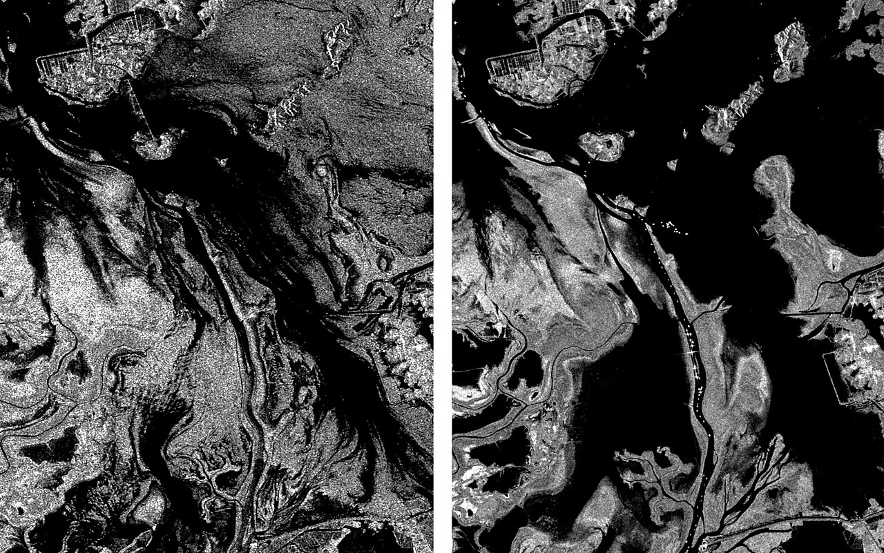
That synthetic aperture is why a small radar can reach sharp resolution. The processing also uses the tiny frequency shifts caused by relative motion, called Doppler shifts, to place each echo precisely along the flight path. The finished image shows brightness by reflectivity: flat water looks dark, because it reflects the signal away, and metal structures, corners and ships look bright.
SAR vs optical satellite imagery
| Factor | SAR | Optical |
|---|---|---|
| Energy source | Its own microwave pulses (active) | Reflected sunlight (passive) |
| Weather | Sees through cloud, rain and smoke | Blocked by cloud and haze |
| Darkness | Works at night equally | Needs daylight or infrared |
| Image look | Grayscale radar reflectivity, speckle noise | Familiar color photo |
| Interpretation | Needs trained analysts or software | Easier for non-specialists |
| Change detection | Coherent comparison can show mm-scale shifts | Visual differences only |
Optical imagery remains easier to read, and the two sources are usually fused. SAR fills gaps when clouds hide a target or when a decision cannot wait for sunrise. It also avoids much of the concealment problem from darkness and smoke, although it does not see through thick metal or underground structures.
SAR satellite bands and modes
| Band | Typical use | Example systems |
|---|---|---|
| X-band | High-resolution imaging, vehicles and ships | TerraSAR-X, ICEYE, Capella, COSMO-SkyMed |
| C-band | Wide-area monitoring, sea ice, floods | Sentinel-1, RADARSAT |
| L-band | Vegetation and ground penetration, deformation | ALOS-2, NISAR |
| P-band | Deep foliage and ground penetration (limited use) | ESA Biomass mission |
Operators trade coverage against sharpness. A wide-swath mode covers hundreds of kilometers at coarser resolution, good for finding ships. A spotlight mode steers the beam to dwell on one area longer and produces the sharpest images, but for a much smaller footprint. Some companies advertise resolution of roughly 25 cm or better in these modes, figures that are manufacturer claims.
What is SAR used for in the military
Military users value SAR for persistent surveillance. Typical tasks include tracking ships at sea, spotting aircraft and vehicles at bases, and watching port or airfield activity regardless of the weather. Coherent change detection compares two images of the same place and flags tracks, dug positions or disturbed soil that an optical comparison would miss. Interferometry, known as InSAR, measures ground deformation and can reveal subsidence, construction or tunneling.
The war in Ukraine brought the technology to a wider audience. Commercial SAR imagery from small-satellite operators has been used by governments and analysts to monitor troop movements and strike damage when skies were overcast, showing how private constellations supplement state systems. For a company profile of one of these operators, see our piece on ICEYE.
Which SAR satellites are in orbit
Government systems include the European Copernicus Sentinel-1 series, Italy’s COSMO-SkyMed, Germany’s SAR-Lupe successor SARah, Canada’s RADARSAT Constellation, Japan’s ALOS-2 and the classified satellites of the US National Reconnaissance Office. Chinese state programs fly a growing number of Yaogan-series radar satellites, and Chinese capabilities are described mostly by state media, so their performance figures are manufacturer or official claims.
Commercial players such as ICEYE, Capella Space and Umbra have launched dozens of small radar satellites, cutting revisit times from days to hours. This trend is part of a larger shift toward proliferated low Earth orbit networks, which we explain in our guide to military LEO constellations. Radar processing also connects to the physics behind AESA radar, which uses many small transmit-and-receive elements to steer a beam electronically.
SAR satellite frequently asked questions
What does SAR stand for in satellites?
Synthetic aperture radar, a technique that uses a satellite’s motion to simulate a much larger radar antenna.
Can SAR see through clouds?
Yes. Microwaves pass through cloud, rain and smoke, so SAR images the surface in almost any weather.
Can SAR satellites see underground?
Not meaningfully. Longer wavelengths such as L-band penetrate dry soil and foliage a little, but SAR is not a tool for seeing deeply buried objects.
How sharp are SAR images?
Government and commercial spotlight modes reach sub-meter detail, with some operators claiming around 25 cm.
Why do SAR images look grainy?
Coherent radar echoes interfere with each other, producing a speckle pattern that analysts reduce with filtering and multiple looks.
- European Space Agency – Sentinel-1 mission documentation
- Manufacturer and operator literature (ICEYE, Capella Space, Umbra)
- Wikipedia – Synthetic-aperture radar (accessed October 2026)
- Defence & Tech reporting