
TERCOM and DSMAC, How Cruise Missiles Navigated Before GPS

TERCOM and DSMAC are the two map-matching guidance systems that let cruise missiles hit targets precisely decades before GPS existed, and both date to research begun in 1958. With satellite navigation now jammed across whole regions, the Cold War techniques that steered the first Tomahawks are back at the center of guided weapon design.
What is TERCOM
Terrain Contour Matching answers a simple question with radar, does the ground beneath me look like the map I memorized? Before launch, mission planners load the missile with digital elevation strips along the route. In flight, a radar altimeter measures the terrain profile passing below while a barometric altimeter tracks absolute height, and the guidance computer correlates the measured profile against the stored strips, fixing position and correcting the inertial system’s drift at each checkpoint.
The elegance is robustness, terrain does not move and cannot be jammed. The limitations are just as structural. TERCOM needs distinctive relief, so flat farmland, deserts and open water give it nothing to match, and every route demands laboriously surveyed map data, which made Cold War mission planning a days-long affair run by specialist centers.
What is DSMAC
Digital Scene Matching Area Correlation is the endgame counterpart. Near the target, a downward-looking camera images the ground and the computer correlates what it sees against stored reference scenes, typically prepared from satellite photography, snapping the missile’s position to within meters. Where TERCOM reads the shape of the land, DSMAC reads its appearance, buildings, road junctions, field boundaries.
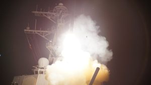
DSMAC brought its own constraints, scenes change with seasons, snow and battle damage, lighting matters, and reference imagery must be fresh. Planners historically paired several DSMAC scenes along the final approach so the missile could reject a bad match. The combination of TERCOM en route and DSMAC at the target is what gave the Tomahawk its reputation for flying through a chosen window in 1991.
TERCOM vs DSMAC vs GPS
| Method | How it fixes position | Strength | Weakness |
|---|---|---|---|
| TERCOM | Radar altimeter profile matched to stored terrain maps | Unjammable, all-weather, long legacy | Needs distinctive terrain and heavy map preparation |
| DSMAC | Camera scene matched to stored imagery near the target | Meter-class terminal accuracy without signals | Sensitive to scene changes, lighting and weather |
| GPS/GNSS | Satellite ranging | Cheap, global, no terrain needed | Jammable and spoofable; denied in contested zones |
| INS | Integrates acceleration and rotation continuously | Fully autonomous | Drifts with time; needs the other methods for fixes |
Which missiles use TERCOM and DSMAC
| Missile | Nation | Guidance approach |
|---|---|---|
| BGM-109 Tomahawk | USA | TERCOM en route, DSMAC terminal on conventional variants, plus GPS |
| AGM-86 ALCM | USA | TERCOM with inertial navigation; retired 2024 |
| Kh-55 / Kh-101 family | Russia | Terrain-referenced navigation plus scene matching, per open analyses |
| Kalibr | Russia | Terrain-referenced and satellite navigation, per open analyses |
| CJ-10 family | China | Assessed to use terrain and scene matching; unconfirmed |
| Storm Shadow / SCALP, Taurus KEPD 350 | UK/France, Germany | Terrain-referenced navigation with imaging infrared scene matching |
The American Tomahawk and the retired AGM-86 ALCM built their reputations on TERCOM, with DSMAC added on the conventional Tomahawk variants. Russia’s Kh-55 family and the Kalibr line use equivalent terrain-referenced techniques, per open analyses of recovered debris, and China’s CJ-10 family is generally assessed to do the same, an assessment rather than a confirmed specification. European weapons brought the concept forward, Storm Shadow and Germany’s Taurus KEPD 350 pair terrain-referenced navigation with imaging infrared scene matching in the terminal phase, updating DSMAC’s logic with modern sensors.
Why map-matching guidance is back
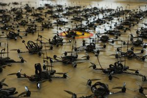
GPS made map matching look like an expensive relic, Block IV Tomahawks leaned on satellite fixes and simplified planning, and a generation of cheap guided weapons skipped terrain sensors entirely. Ukraine reversed the fashion. With Russian jamming degrading satellite-guided rounds, weapons carrying autonomous terminal guidance kept hitting, and manufacturers now advertise GPS-independent navigation the way they once advertised GPS itself. The modern versions barely resemble their ancestors, digital terrain databases are global and instantly accessible, computer vision replaces hand-prepared correlation scenes, and machine-learning-based terrain-relative navigation runs on chips small enough for artillery shells and drones, part of the same electronic warfare arms race that broke GPS’s monopoly. The hypersonic generation adds its own reason, a weapon sheathed in plasma cannot always hear satellites, but it can still read the ground.
TERCOM and DSMAC frequently asked questions
What does TERCOM stand for?
Terrain Contour Matching, a navigation method that compares radar altimeter readings of the terrain below against stored elevation maps to fix a missile’s position.
What does DSMAC stand for?
Digital Scene Matching Area Correlation, a terminal guidance method that matches camera images of the ground near the target against stored reference scenes.
Can TERCOM be jammed?
No. It emits only a radar altimeter signal downward and relies on the shape of the terrain itself, so there is no external signal to jam or spoof.
Does the Tomahawk still use TERCOM?
Modern Tomahawks blend inertial, GPS, TERCOM and DSMAC-derived techniques so the missile can fall back on map matching when satellite signals are denied.
Why does TERCOM not work over water?
Because the sea has no stable terrain profile to match. Anti-ship and over-water routes rely on inertial navigation, satellite fixes and active seekers instead.
- Declassified US program histories of cruise missile guidance development
- Wikipedia – TERCOM and DSMAC (accessed October 2026)
- Open-source analyses of Russian and Chinese cruise missile guidance, noted as assessments
- Defence & Tech reporting